The Atatürk Library Map Collection includes 14,808 maps.
View the items in this collection in the catalogue
The Atatürk Library Map Collection includes 14,808 maps of which more than 6000 have been digitized and made available for access. The archive contains mostly handmade maps, and is one of the most important map archives in Turkey in terms of size and usefulness.
The collection contains early physical maps of Istanbul, city plans, cadastral maps, Erkan-ı Harbiye maps, fire maps, expropriation maps, allotment and direction maps that illuminate the last three centuries of Istanbul.
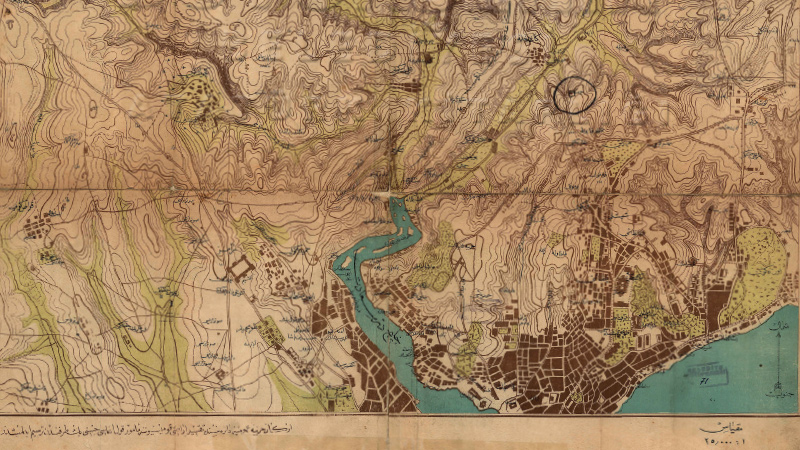
The mapping of Istanbul, that would go on to form the basis for the urban planning of the city, was carried out during the period of Halil Eldem's administration (1909-1910) using a triangulation system. This work was delegated to the French Topographical Society who established a triangulation system centered on the Galata Tower. In 1913, further triangulation-based mapping was contracted to the German company, “Deutsch Syindikat für Staebaliche Arbeiten”. The maps created include all of Suriçi Istanbul as well as residential centers such as Eyüp, Beyoğlu, Beşiktaş, Kadıköy, Üsküdar, and Kadıköy. These maps, called the “German Blues”, were used for everything from zoning plans to the construction of water transmission lines. Today, these maps remain in use for restoration works and the identification of historical artifacts.
These plans include the names of neighborhoods, districts, streets, avenues, and buildings.
The following are shown with their names and dimensions: official buildings such as palaces, embassy buildings, police stations, fire brigades, municipalities, religious buildings such as mosques, dervish lodges, madrases, graveyards, burial areas, tombs, churches, synagogues; military structures such as towers, walls, city walls, barracks, gendarmerie stations, shipyards, workshops, quartermaster depots etc.; public structures such as hospitals, piers, railways, rail stations and terminals.
The Cadastra de la Ville de Constantinople, the cadastral plans of Beyoğlu during the reign of Sultan Abdülaziz, maps the regions from Beşiktaş to Sarıyer under the name of Rumeli Ciheti Maps.
The collection also includes maps covering different regions of the Empire, allowing one to examine the historical topography of the Ottoman period, as well as maps of European history, Asian history, and the Soviet Union.